Ditrău (Comuna Ditrău)
Ditrău (Ditró or Gyergyóditró ) is a commune in Harghita County, Transylvania, Romania. It is composed of three villages: Ditrău, Jolotca (Orotva), and Țengheler (Csengellér or Cengellér).
The commune sits near the river Martonca, 714 m above sea level. The highest point of Ditrău is the Piricske height. Ditrău was first registered in 1567, as Gitró, with 26 gates. There is a significant syenite reserve near the village.
The villages belonged first to the Székely seat of Gyergyószék, which was subsequently absorbed into Csíkszék, until the administrative reform of Transylvania in 1876, when they fell within the Csík County in the Kingdom of Hungary.
After the Hungarian–Romanian War of 1919 and Treaty of Trianon of 1920, the villages became part of the Kingdom of Romania and fell within Ciuc County during the interwar period. In 1940, the Second Vienna Award granted Northern Transylvania to Hungary and the villages were held by Hungary until the fall of 1944.
After Soviet occupation, the Romanian administration returned in March 1945. Between 1952 and 1960, the commune fell within the Magyar Autonomous Region, between 1960 and 1968 the Mureș-Magyar Autonomous Region. In 1968, the region was abolished, and since then, the commune has been part of Harghita County. From January to March 2020, a xenophobic incident occurred between the local population and two Sri Lankan immigrants who worked at the bakery Ditrói Pékség.
Map - Ditrău (Comuna Ditrău)
Map
Country - Romania
 |
 |
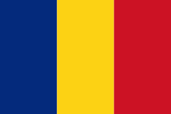
| Flag of Romania | |
Europe's second-longest river, the Danube, rises in Germany's Black Forest and flows southeasterly for 2857 km, before emptying into Romania's Danube Delta. The Carpathian Mountains cross Romania from the north to the southwest and include Moldoveanu Peak, at an altitude of 2544 m.
Currency / Language
| ISO | Currency | Symbol | Significant figures |
|---|---|---|---|
| RON | Romanian leu | lei | 2 |
| ISO | Language |
|---|---|
| HU | Hungarian language |
| RO | Romanian language |


